


Photo Essay: Just Enough Fire
Scenes from a prescribed burn on the Arizona Trail

In our last newsletter I shared photos of the surprisingly sublime effects of lightning and low-scale fire on foxtail pines in the High Sierra. The burn there felt less catastrophic than many which I’ve seen, which often leave the soil and rock as charred and damaged as the trees, and I wanted to show some of the more gentle results of wildfire.
Just after realizing I had yet to share those pictures from the Sierra, I remembered I had also taken photos of a prescribed burn this spring, on a hike I did along the Arizona National Scenic Trail in early April. They’re not the most exciting photos from that trip, but I think they’re of interest for clearly capturing what an intentional burn does.
The coverage of fire here at Unsettling has generally been with the aim to help us get accustomed to living with fire in a different way, in this new climate era. It’s also meant to continue building support for both prescribed and cultural burning (which are sometimes related but not always the same thing). My intent is for the photos below to provide some context for just how different it can be from other kinds of fire events.
I’m also hoping that the relevance of this topic for everyone—not just those of us who live in close proximity to frequent wildfires—is clear by now. I have, in the past, had conversations with readers on this list who live further east than I do, who have referred to much of what we cover here as “rural” or “Western,” implying that it doesn’t matter for someone living in, say, Chicago or New York. Such a distinction has always baffled me—we should know, by now, that our cities are completely dependent on rural spaces (where does your food come?) and also that both the climate and our economic and social worlds span across regions. Globalization continues ever apace, in all realms, destabilizing all those neat binaries we continue trying to maintain, such as the urban/rural. Likewise the attempt to build man-made borders means nothing when it comes to climate and the more elemental forces, such as wind and air. Wildfire smoke doesn’t bother with passports. That fact has become ever more obvious this summer with smoke from Canada—both its eastern and western ends—descending into U.S. locales, major metropoles and small towns alike.
So it is that land management practices and forest policies in places thousands of miles away come to bear on our daily life, no matter where we are. And it’s why I hope you East Coast folks will take some of what you read here and use it to prevent any anti-burning sentiment from more broadly taking root amongst those near you. There are plenty of folks this year who are being newly exposed to smoke, and who likely see only the scary photos of wildfire and—if they are environmentally inclined at all—have probably been exposed to decades of “save the trees!” propaganda that also encourage them to dislike the idea of burning. Not that we shouldn’t plant and protect trees; but sometimes, burning is the way to do that. It is how we prevent excessive exposure to smoke in the long run.
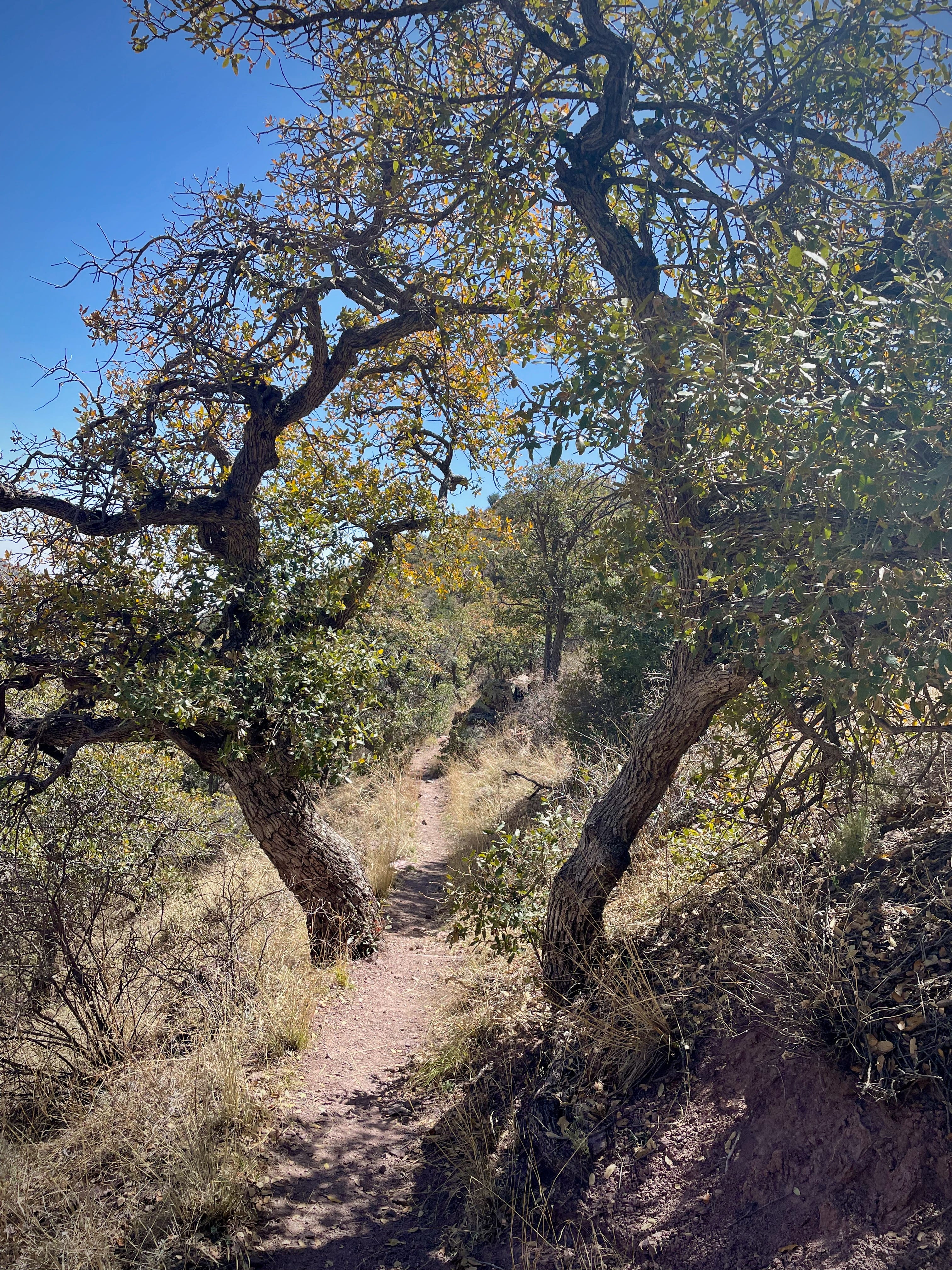
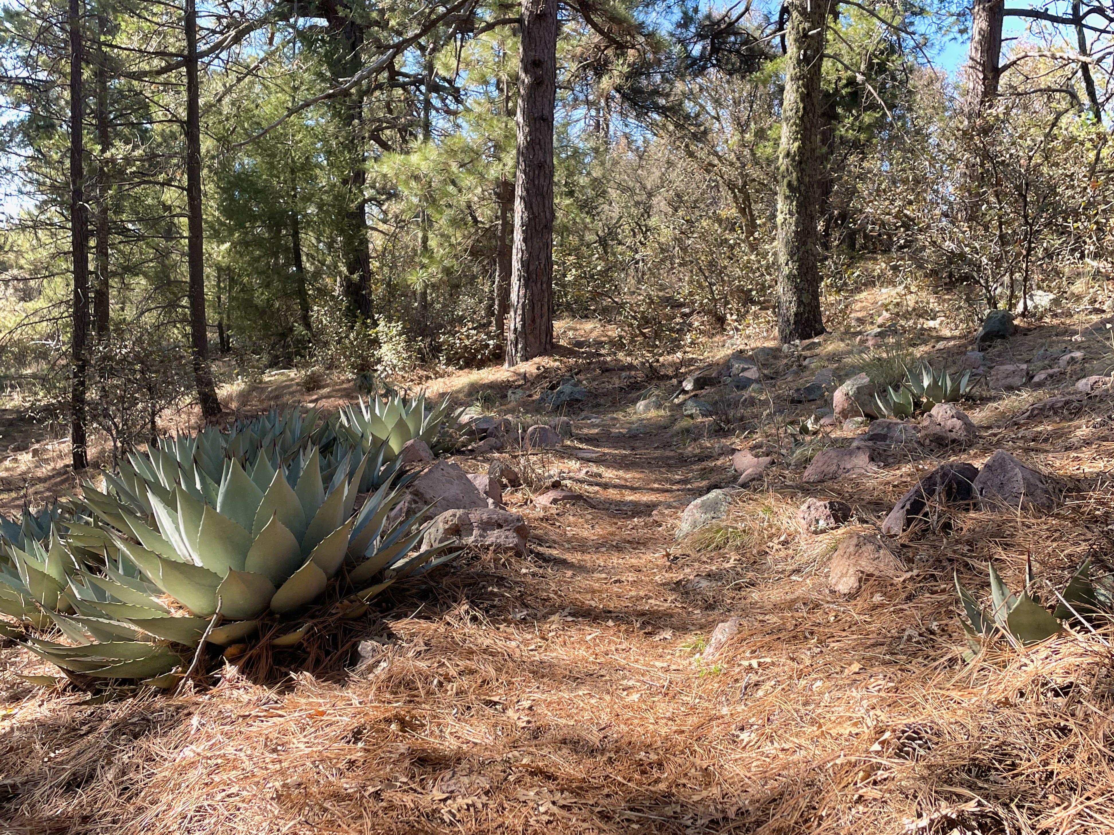
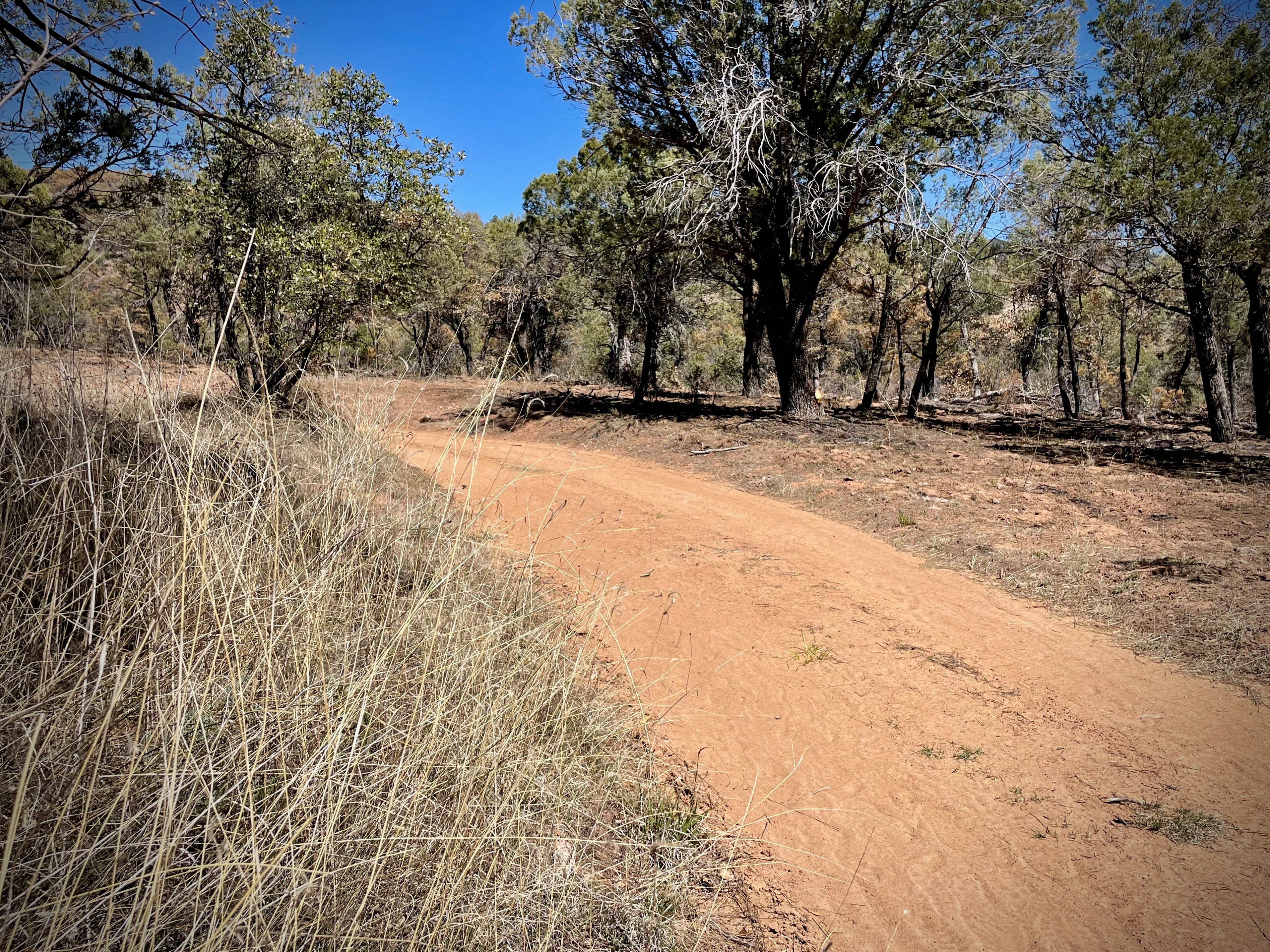
Let’s start with a few somewhat typical pictures of the AZT (as the Arizona Scenic Trail is generally called), which in this part of the state includes scattered oak woods, and ponderosa at higher elevations:
Now, here are some shots from what appears to be a sudden unplanned, hotter fire. The AZT begins at a marker along the U.S.-Mexico border1 and heads north, passing not so far from Canelo, where I was taking natural building courses this spring, as some of you might remember reading. Close to Canelo Pass, there are a few slopes that look like this:
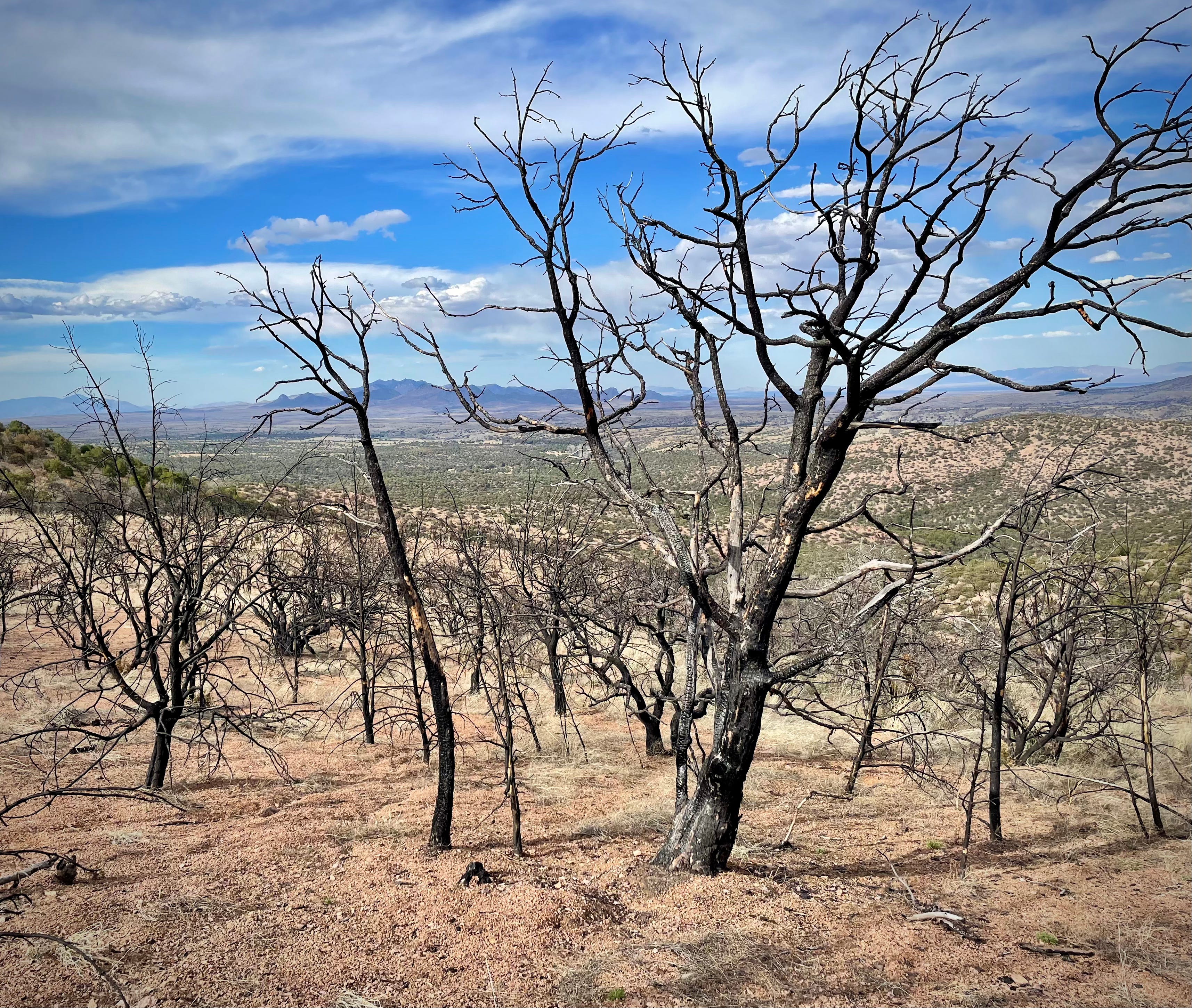
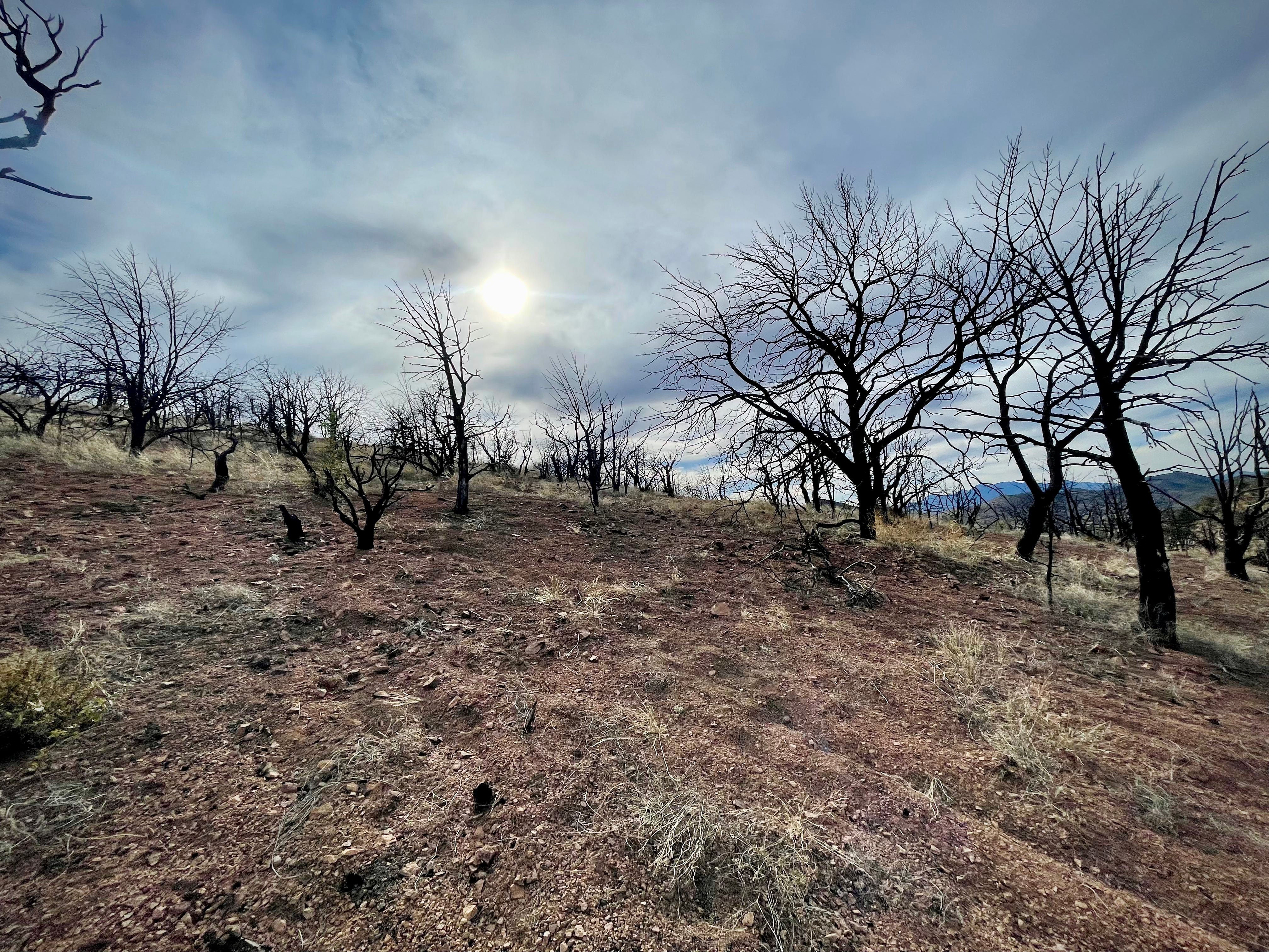
The fire appears to have killed everything in this small area; the grasses are barely returning, and these trees, while standing, are also not coming back to life.
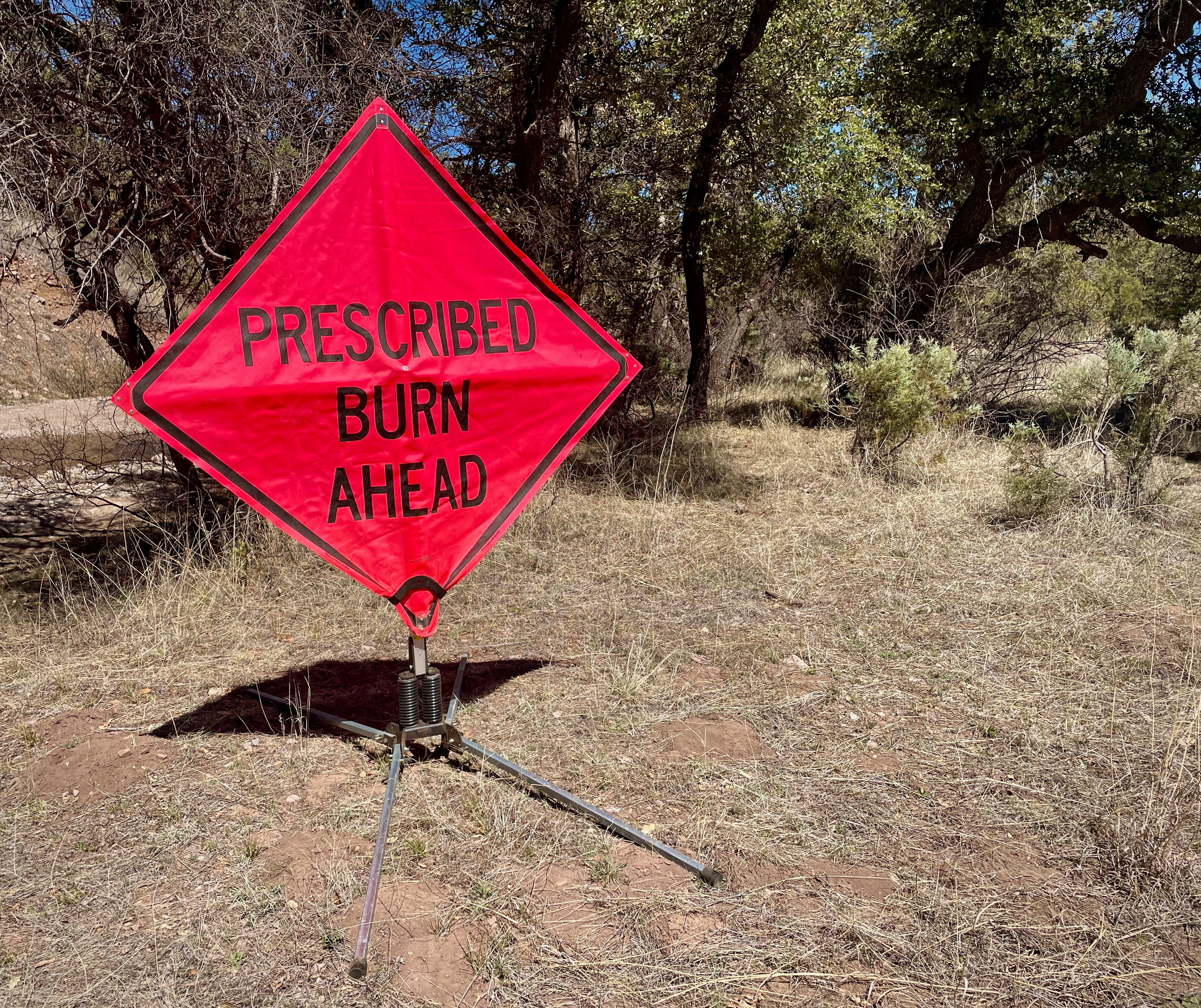
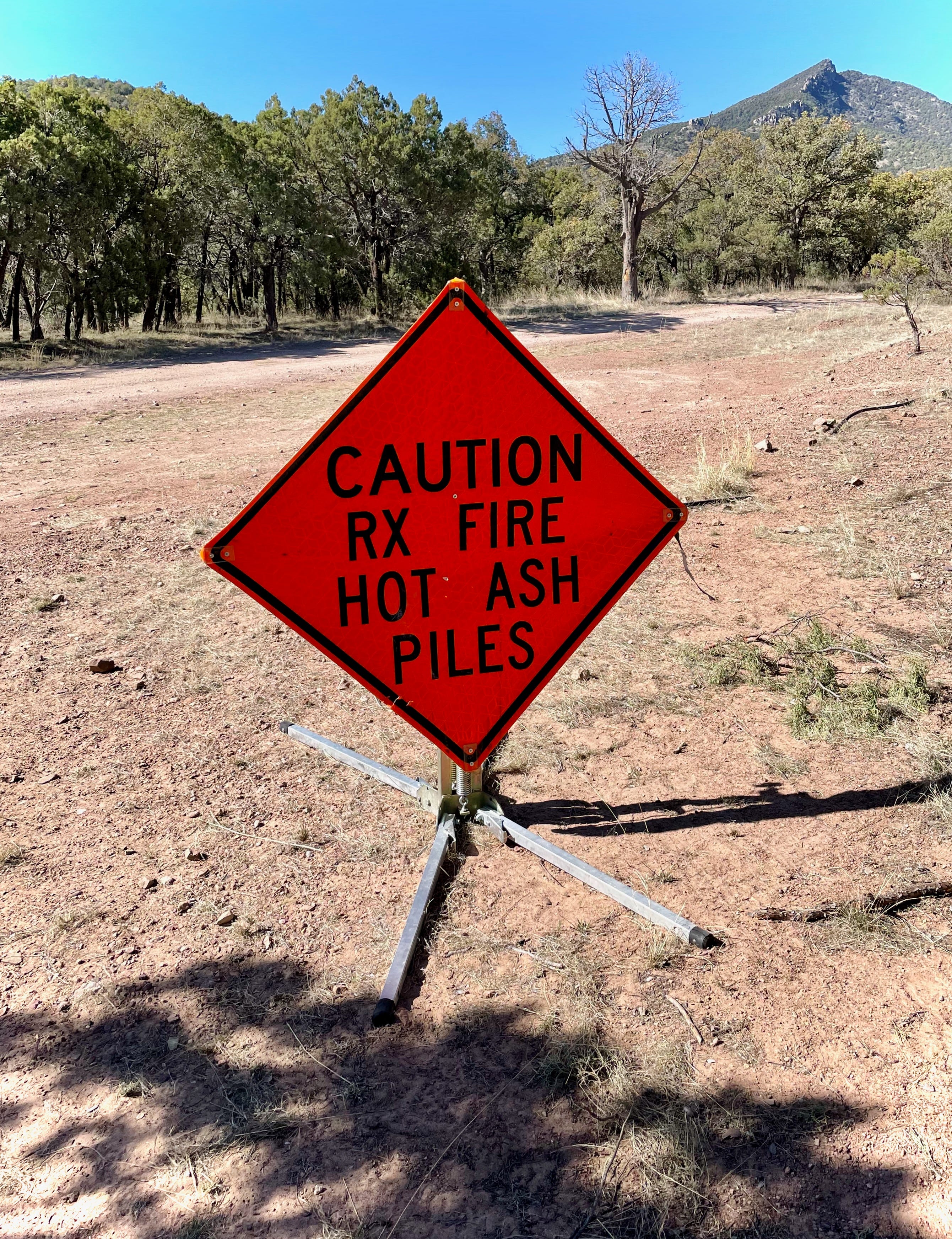
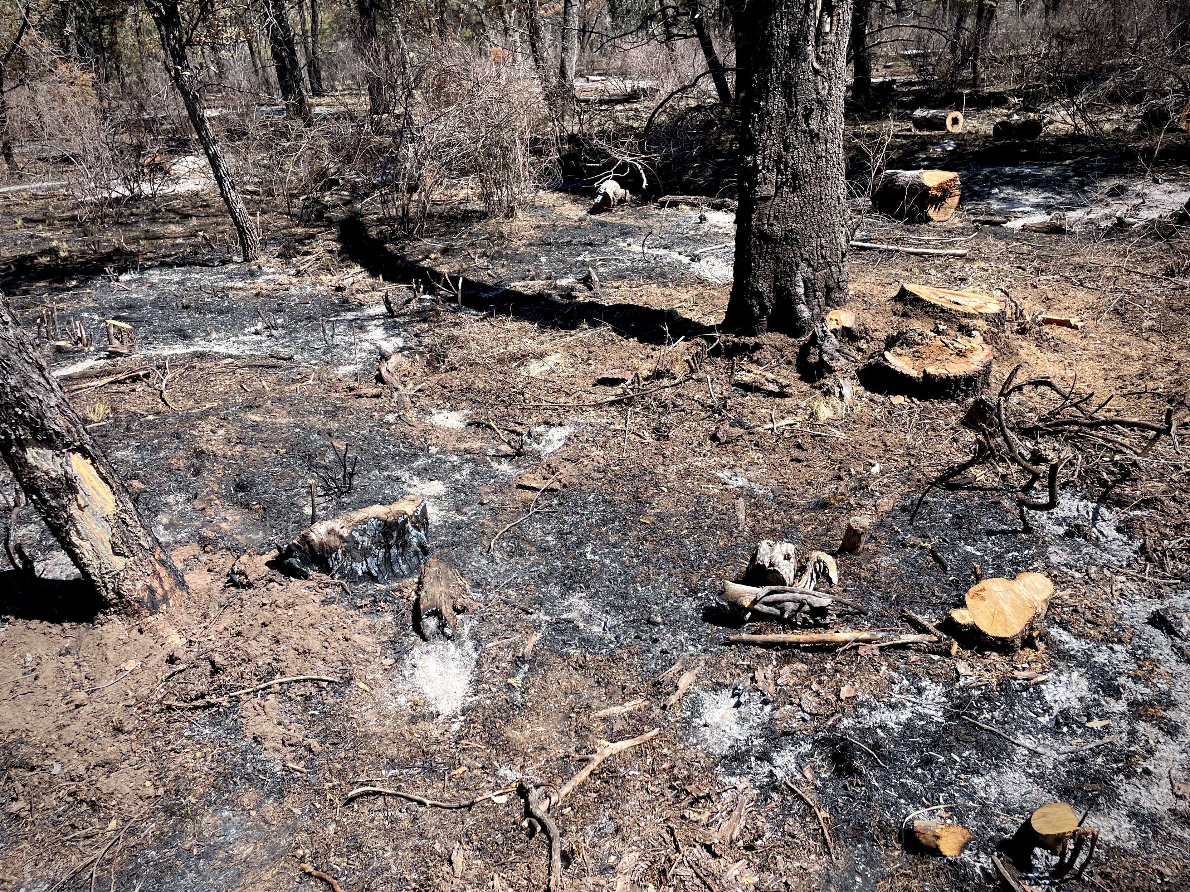
Now, contrast that to a prescribed burn which I happened upon further south, in the Coronado National Forest, on the edge of the Coronado National Monument. This is just north of Miller Peak, in a flat area interspersed with pasture land just before one enters Sunnyside Canyon and begins to ascend upward.
There were no active workers the day I passed through, just a few signs to mark that something had happened:
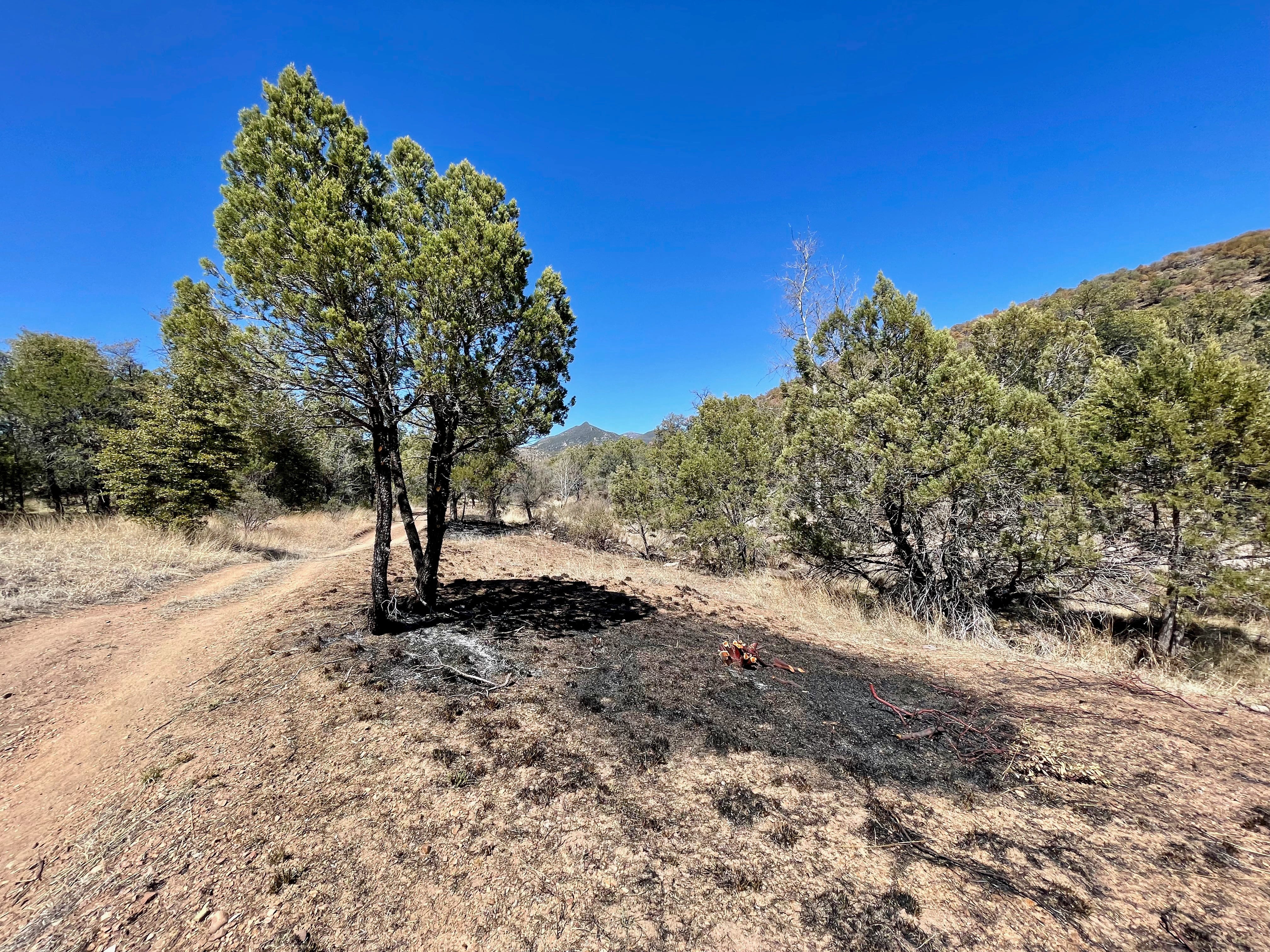
Not long after these signs, I began to see trailside patches that looked like this:
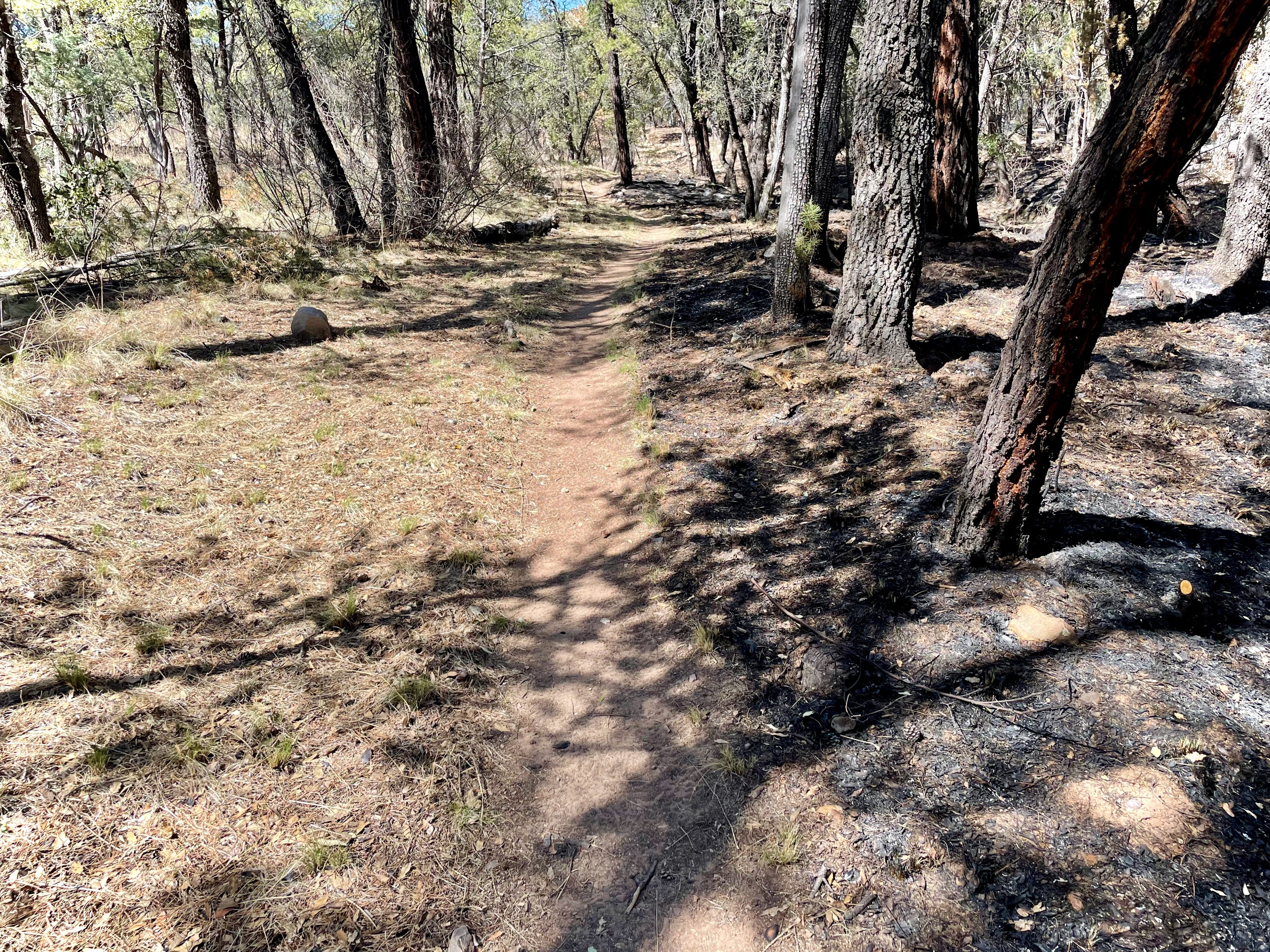
The ground is newly bare and burned, but you’ll notice that this juniper is hardly touched, unlike the trees near Canelo Pass.
The burn was concentrated on one side of the trail, and so it’s easy to see all the dry brush—easy tinder to build a fast-moving fire—that was taken out, in comparison to what was there before the crews came through, just by looking from one side to the other.
While these first photos may make it feel especially benign, not everything was quite so neat and contained. Here’s further down the road, where the area of the burn increased and the rough mechanical thinning accompanying the burn is also visible:
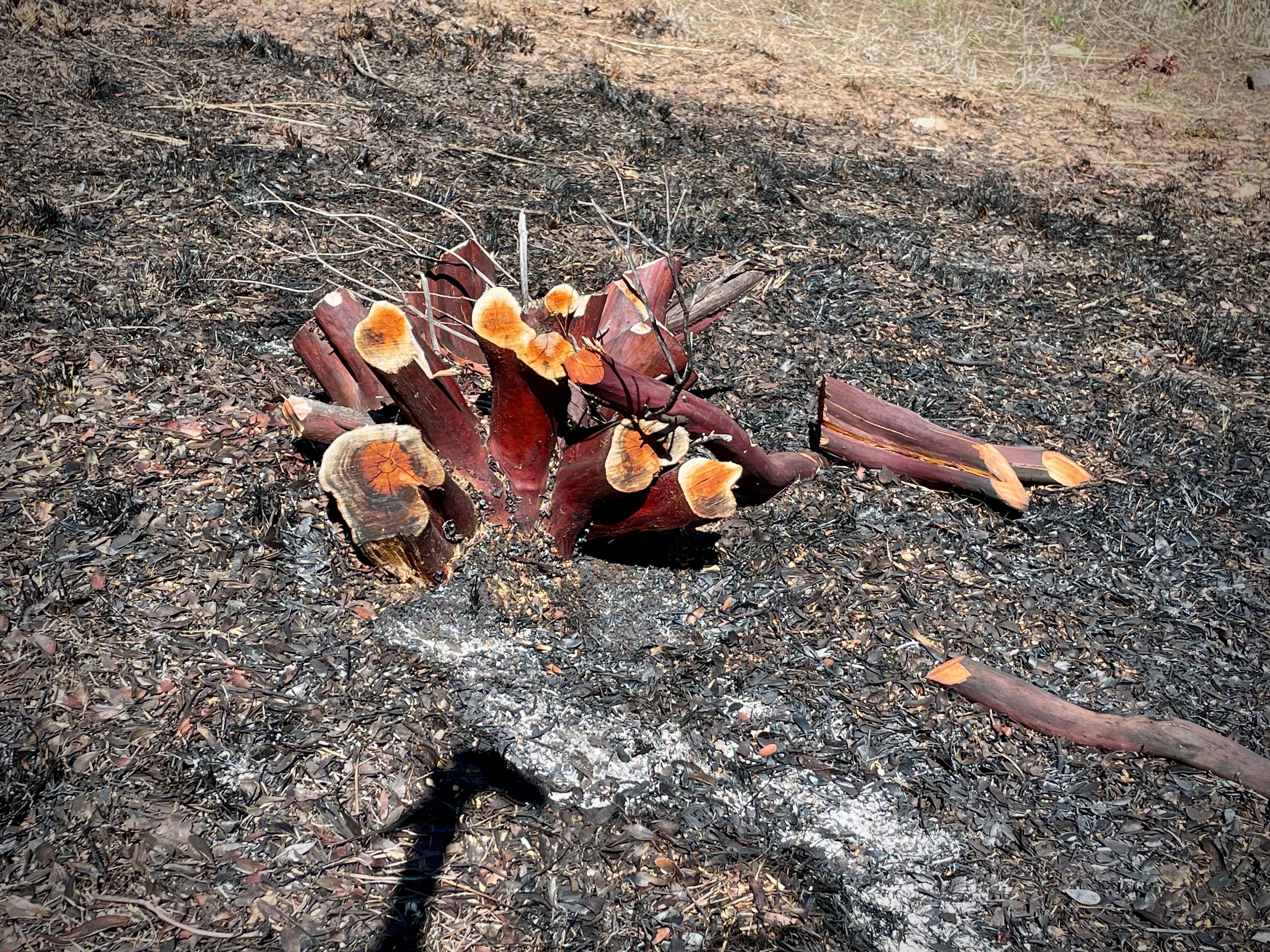
It’s not necessarily super pretty. But again, it becomes clear looking from one side of the trail to the other just how much overgrowth and dry brush has been taken out to prevent random hotter and faster fires from taking place:


The weather was becoming hotter and windier that first week in April, bringing the safe season for prescribed fire there to a close. The signs that were up when I first hiked through were gone again a few days later on my return trip.
I hadn’t known about the burn before I began my trip, so running into it was a little accidental. I’m appreciative for such useful coincidences, and the chance at last to take and share some pictures of what we’ve been advocating for here. I hope you found it useful.
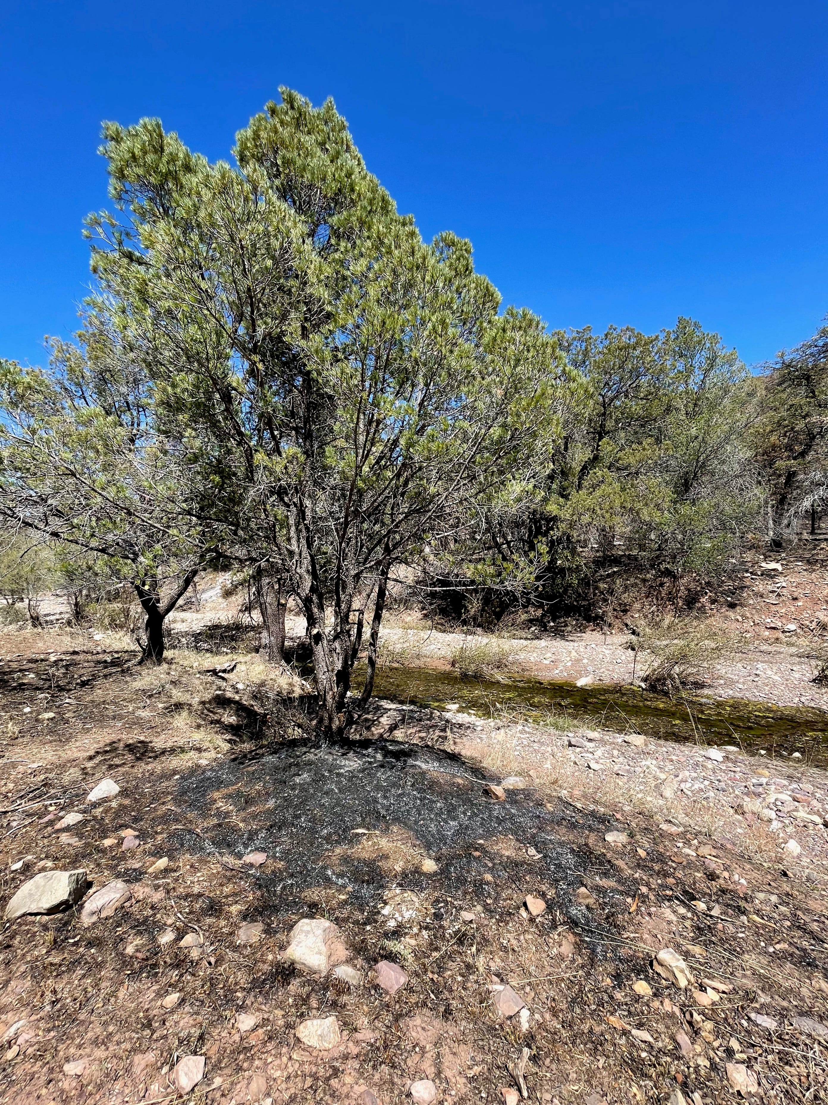
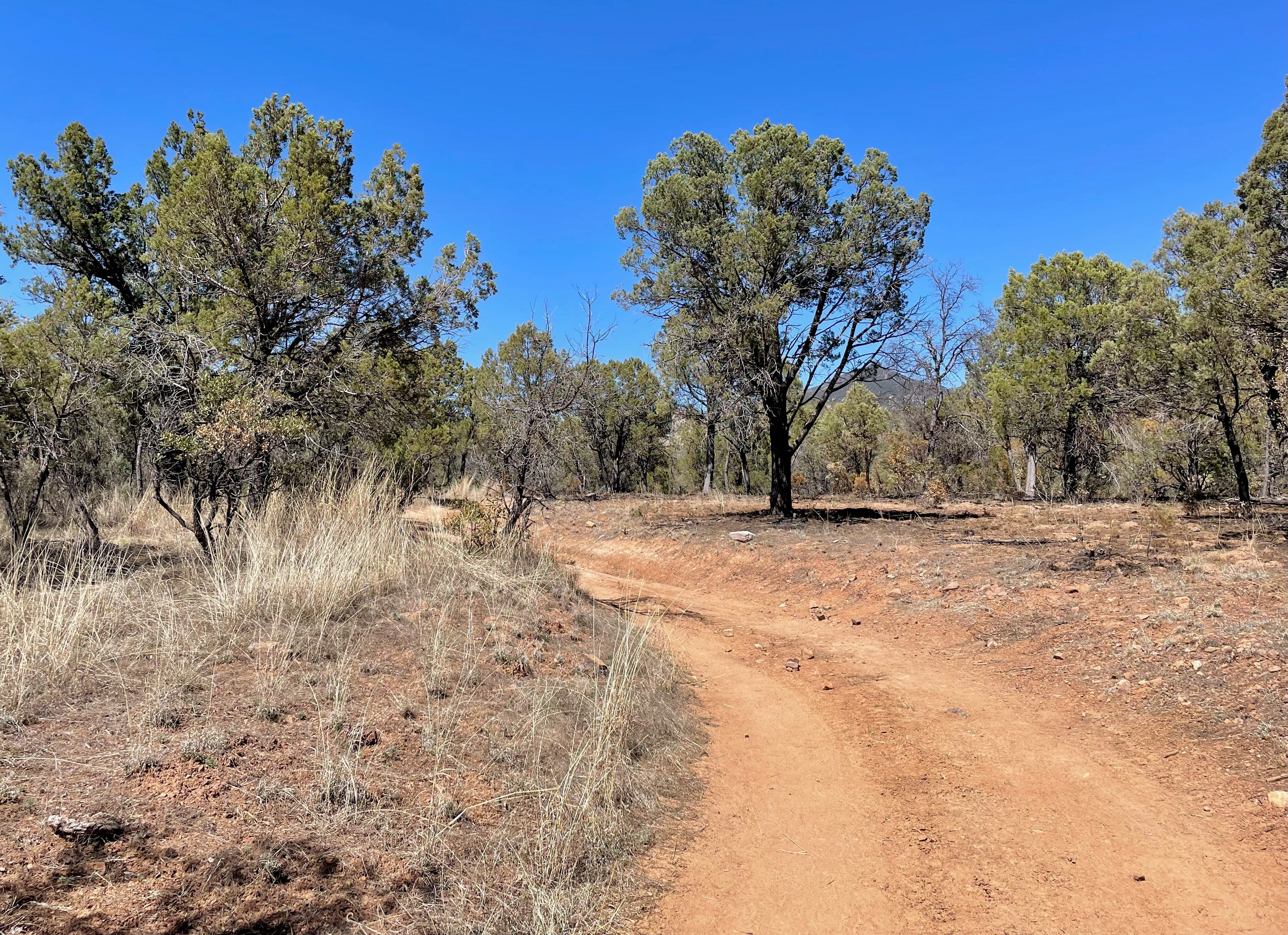
I’m going to close out with a few additional pictures from that trip, because why not enjoy a few more pictures of beautiful desert?
Until next time,
Meg


All images in this piece (and at Unsettling more broadly) are by the author unless otherwise noted. Works on this page and in the newsletter email may be shared under the terms of the Creative Commons Attribution-NonCommercial-No-Derivatives 4.0 International License. Please cite as “Just Enough Fire: Scenes from the AZT” by Meg Wade with a link to unsettling.substack.com.
There’s always much to be said about the border, the least of which is that it cuts an imaginary line through the pre-existing homelands of the Tohono O’odham and other Indigenous groups, a line which is more and more physically manifest. The AZT terminus is a place the border wall should not have been built—the lands ostensibly have environmental protections—but illegal construction took place. I have strange photos of that space, too, to be maybe shared another time.